
It’s no secret that Selkirk experienced tremendous growth during its early years. As the town expanded, businesses began appearing along Main Street and Eveline Street, transforming Selkirk into a thriving community.
By 1911, rumours circulated about a proposed 16-foot-wide paved road connecting Selkirk and Winnipeg, further boosting the town’s appeal. Two years later, in 1913, an all-weather, widened highway officially opened, significantly increasing vehicle traffic between the two communities.
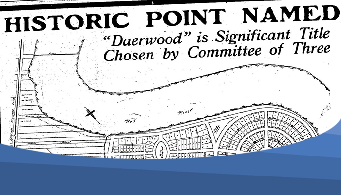
With Selkirk booming, the demand for homeownership and recreational properties grew. Private land development companies saw an opportunity and began planning a new subdivision that would become known as Daerwood Park.
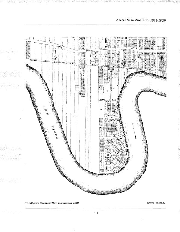
Note that west is at the top of this map, reflecting the original orientation of the source.
Creating Daerwood Park
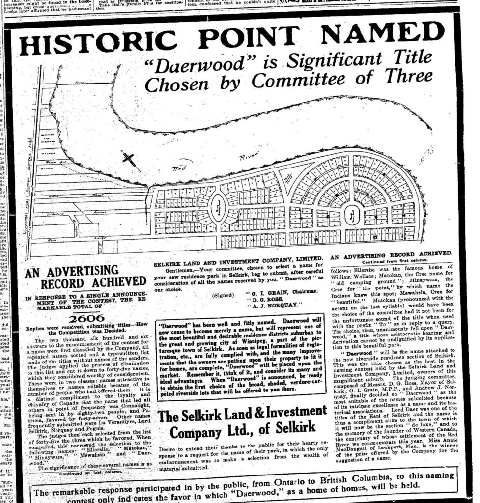
The name “Daerwood Park” was selected through a naming contest held in 1912, with a $50 prize awarded to the winner. Although the winner’s identity has not been found in newspaper archives, the contest attracted an impressive 2,606 submissions from people across the country.
The development was proposed by the Selkirk Land and Investment Company, founded in 1904 by R.C. Moody, J. Grisdale, F.A. Gemmel, D.G. Ross, Robert Bullock, J. Mailhot, D. Morrison, E.F. Comber, and F. Kochen. The company was established to capitalize on land opportunities between Selkirk and Winnipeg.
Their vision focused on developing the northern half of what was then known as Sugar Point into an exclusive summer cottage community. Promotional materials often described the property as resembling a “vast old English estate.”
They described Sugar Point as:
“The most ideal spot that nature has placed for the suburban homes of Manitoba’s citizens within the confines of the Province. This plot has been surveyed by the foremost landscape architects of Manitoba. Has been gone over inch by inch. Winter and summer and every advantage of nature has been combined with the principles of modern, expert town planning to arrive at an ideal plan. One half of the lots front on Red River, the others line concentric avenues that parallel or look onto the river at some point of its majestic sweep around Sugar Point.”
A Resort for Winnipeg’s Elite
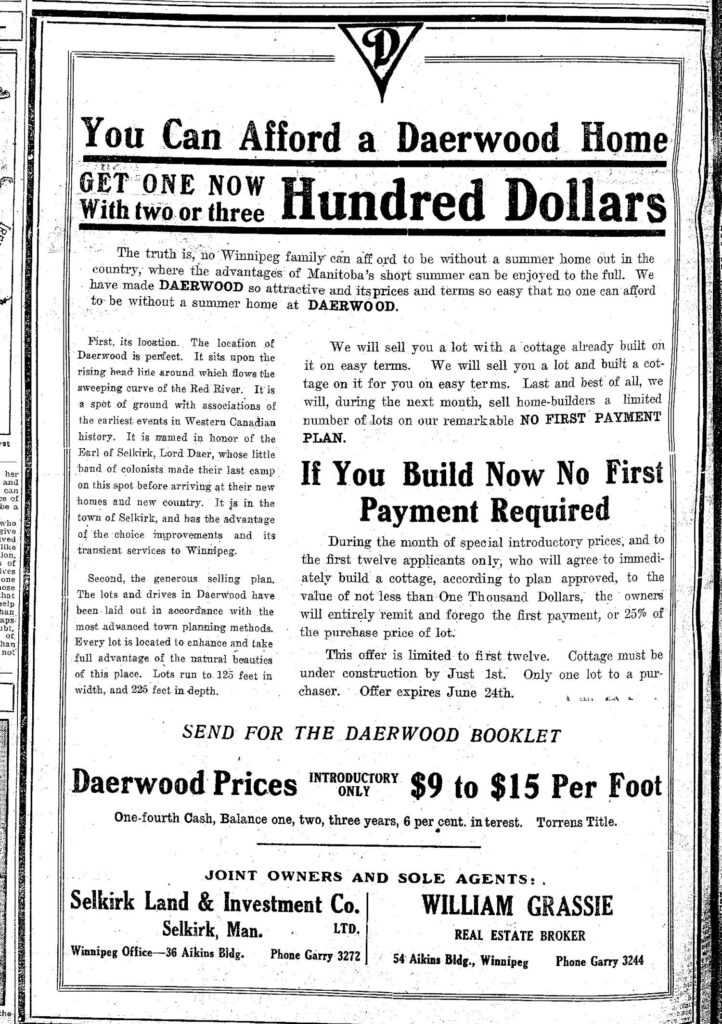
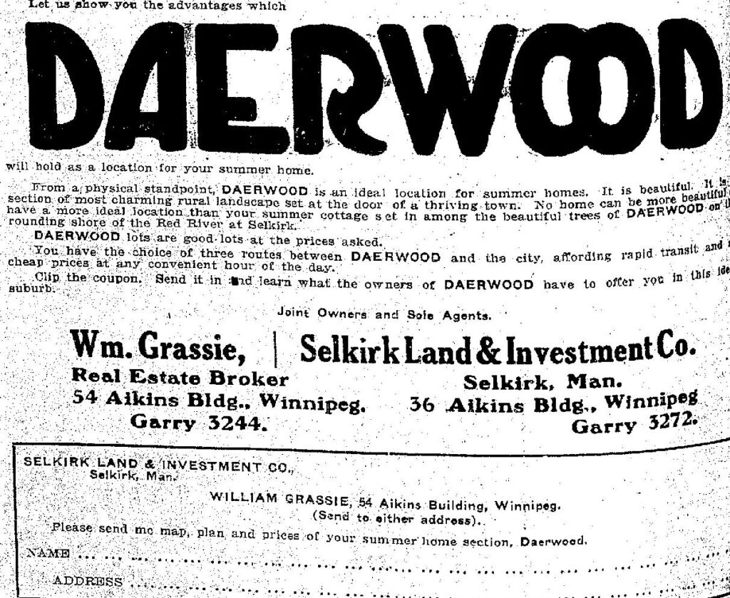
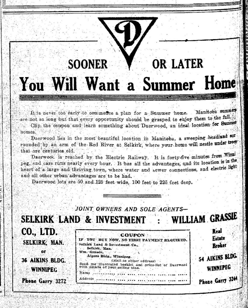
Daerwood Park was designed to appeal to affluent buyers, particularly wealthy Winnipeggers seeking summer cottages along the Red River.
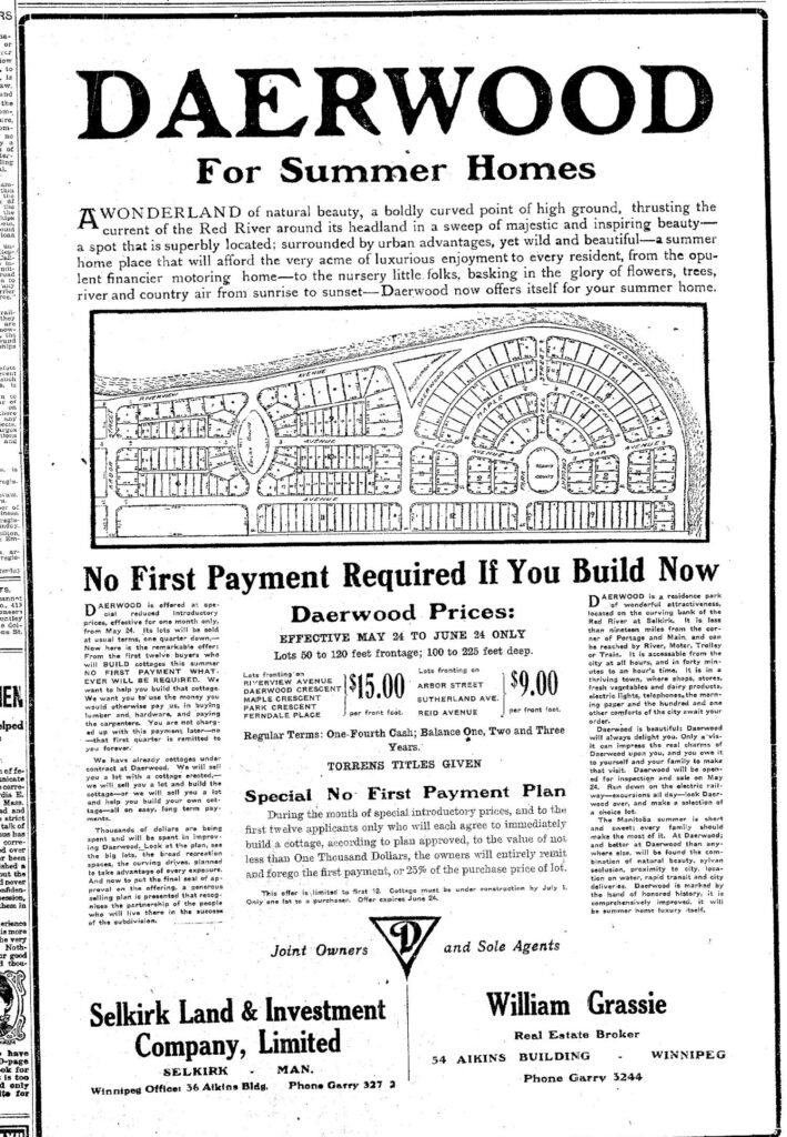
To maintain the subdivision’s prestige, the Selkirk Land and Investment Company required every cottage to have a minimum construction value of $1,000. The spacious lots were advertised as ideal locations for summer homes, conveniently located just a short streetcar ride from Winnipeg.
Riverfront lots sold for $15 per frontage foot, while interior lots were priced at $9 per frontage foot. Riverside properties measured approximately 100 by 120 feet, while interior lots were generally about 50 feet wide. Most lots sold for around $475, with payment plans available to prospective buyers.

Opening Day and Community Life
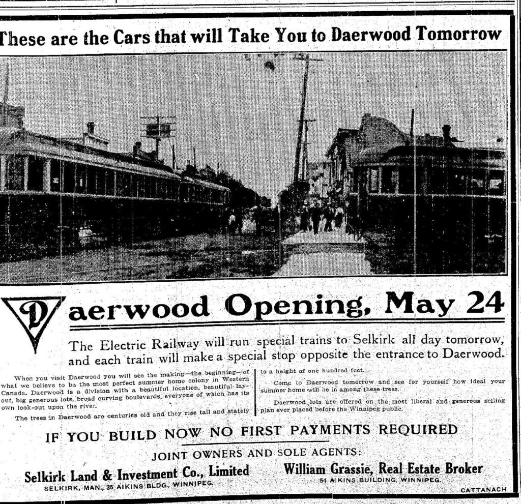
Daerwood Park officially opened on May 24, 1912. To mark the occasion, a special Electric Railway train carried visitors to Selkirk, making a dedicated stop opposite the entrance to the subdivision.
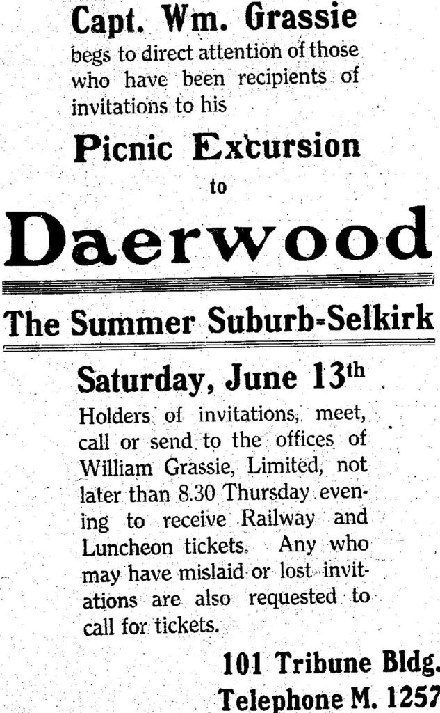
In the years that followed, Daerwood Park hosted a variety of community events, including camping weekends and invitational picnics, helping establish it as a popular seasonal destination.
Flooding and Decline
Despite its attractive setting, Daerwood Park faced a recurring natural challenge. Each spring, ice flowing down the Red River would jam near Sugar Island (located north of Selkirk Park near the airport), causing floodwaters to spill onto the surrounding low-lying land, including portions of Daerwood Park.
Even so, those who purchased lots were still able to enjoy the desirable riverfront setting for a short period.
On the other hand, many ventures came to an abrupt halt in 1914, as economic conditions worsened with the onset of the First World War.
Daerwood Park Today
Rather than disappearing entirely, several Daerwood Park cottages were relocated into Selkirk along Main Street and Dorchester Avenue. At least two of these homes still stand today at 210 and 212 Dorchester Avenue.
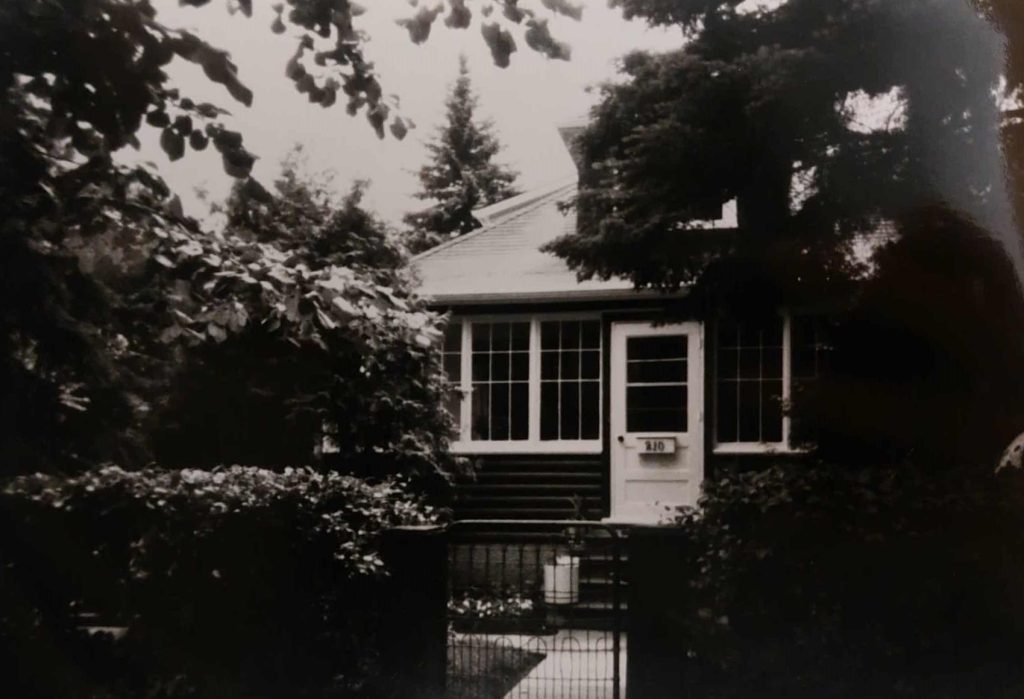
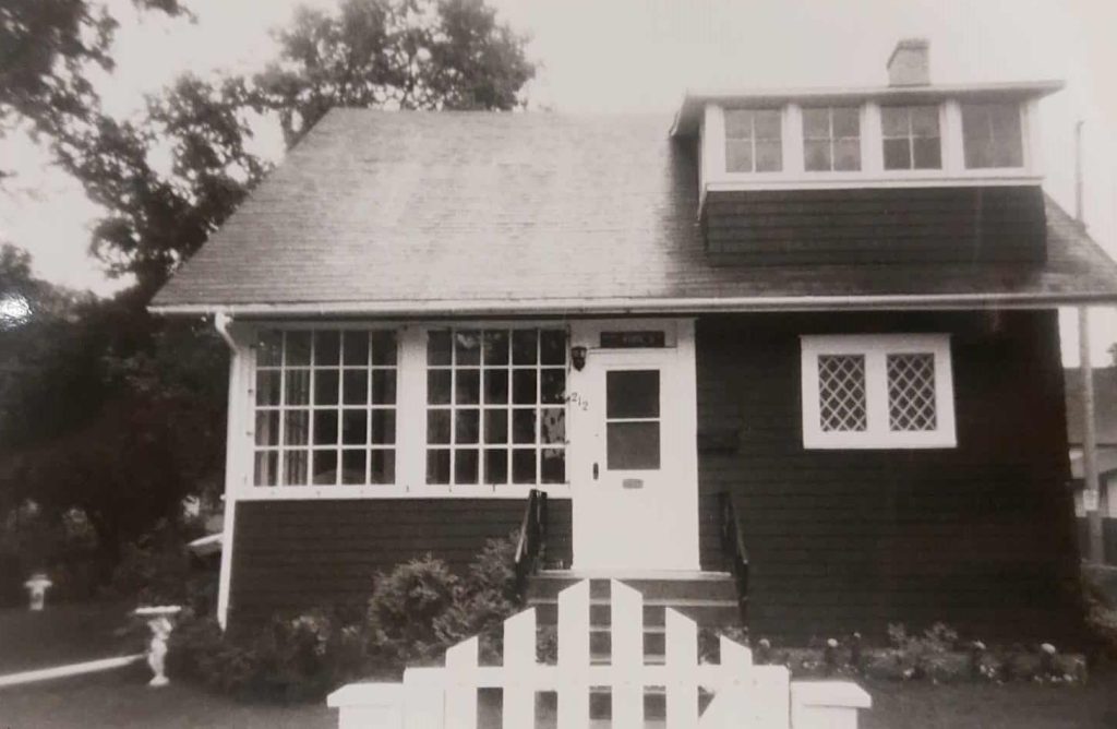
Today, the northern half of Sugar Point is home to the Selkirk Golf and Country Club, which opened as a golf course in 1932. It is protected from flooding by a large dike.
The remaining southern portion of Sugar Point, bordering the east side of Eveline St., has been partially developed as residential housing, starting in the 1950s and continuing to the present. Daerwood Village, a large modern development, includes a small children’s playground.
Beyond the housing, a large natural area stretches east to the Red River. A small part of this, at the end of Dorchester Avenue, has been recognized as a unique ecological area, known as Little Lake Park.
Sources
Daerwood Village Park, City of Selkirk
Sugar Island, Manitoba Fishing Forum
Potyondi, B., Selkirk The First 100 Years
Smith, A., Residential Architecture in Selkirk: A History
Winnipeg Free Press, 1912, 1914, 1918